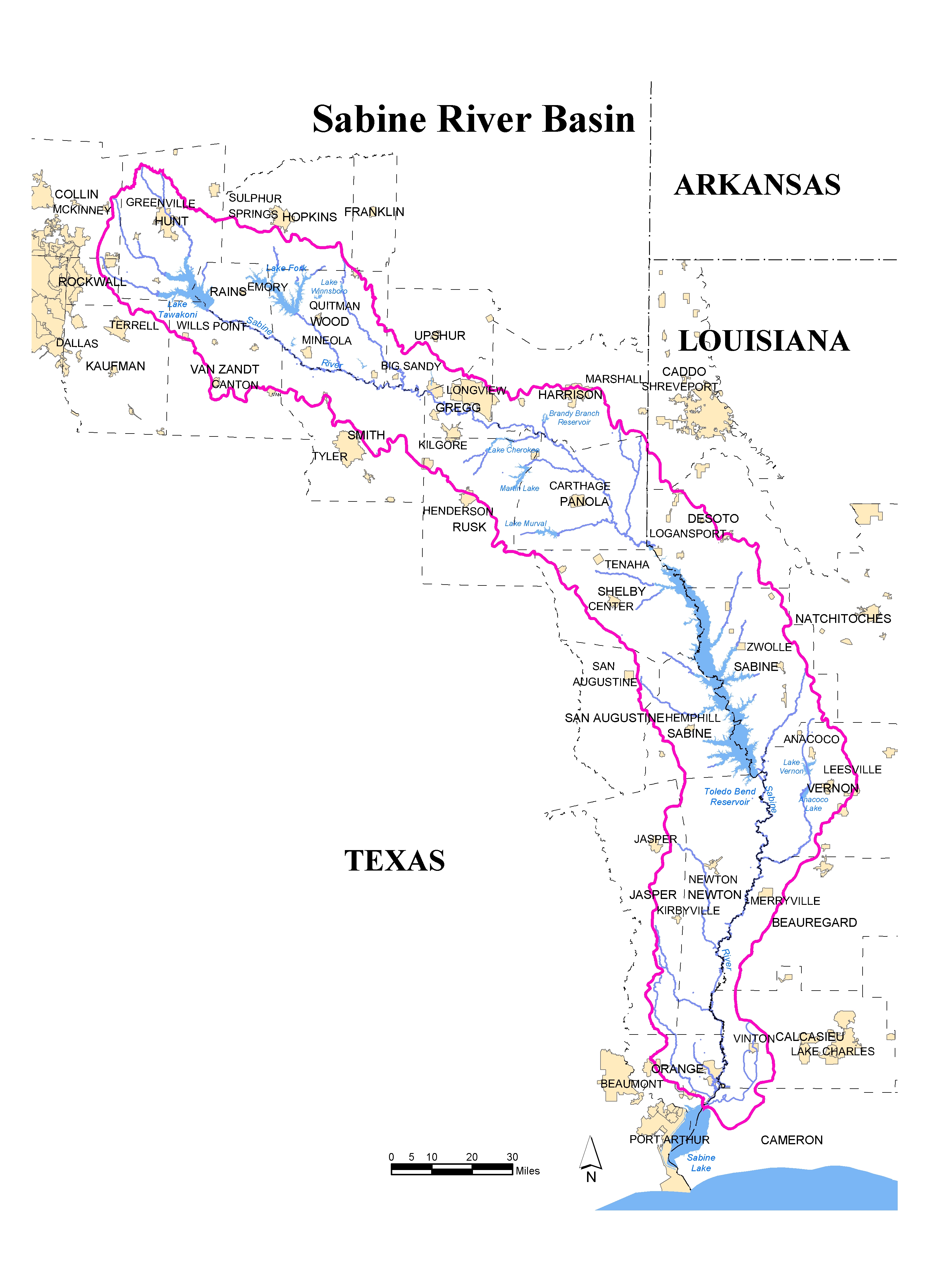
Home >> Sabine River Basin >> Lake and River Conditions


Basin Info. & News

Water Availability

Water Conservation

Water Quality

Lake Levels & River Conditions

Recreation & Parks

Economic Development

About the Authority

Printer Image This page in print-friendly format


U.S. Geological Survey (USGS) Real-time Data for Texas and Lousiana Sabine Basin Stations (PROVISIONAL DATA SUBJECT TO REVISION)

  Streamflow Reservoirs Combined
Texas View Data View Data View Data
Louisiana View Data View Data N/A

Please Note: 08031000 Cow Bayou nr Mauriceville, TX is in the Sabine Basin, not the Neches Basin as listed.

For more current (near-real-time) information regarding the lake and river conditions in the Texas and Louisiana, please see the following Web sites:

National Weather Service
[ Weather Forecast Office Lake Charles, LA (clickable map of stations with hydrographs) | Texas Flash Flood Warnings | Texas Flood Statements | Texas Flood Warnings ]
U.S. Geological Survey
[ Real-time Data for Texas | Real-time Data for Louisiana ]

Sabine River Authority of Texas Daily Readings

The lake and river conditions printed below on this page are daily values. If this page does not load correctly for you, please click here to load our new page. If that does not work, please see SRA Lake and River Conditions page doesn't work.

Lake Conditions[ Toledo Bend | Lake Fork | Lake Tawakoni ]
River Conditions[ Orange | Ruliff | Bon Wier | Burkeville ]

See Also


To address comments to the Sabine River Authority of Texas, please contact us.
http://www.sratx.org/basin/lake_and_river_conditions.asp
This page requested on 5/9/2008 at 8:30:26 PM CST
Home | Privacy Policy
Labelled with ICRA Internet Content Rating Association
State of Texas Web Site Logo State Web SiteTRAIL Logo (Texas Records and information Locator Service) Statewide Search